Understanding data can help drive better community decision-making. This is especially true when communities are positioned as leaders in asking research questions and articulating the answers.
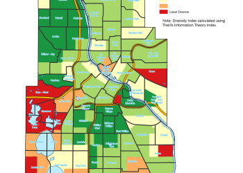
The Community Geographic Information Systems (CGIS) program provides analysis and mapping support to empower community-based organizations and government agencies to make a data-driven case for their work. We fill in critical gaps in capacity to democratize access to public information.
Apply
CGIS support is available on an ongoing basis. Community and local government partners may request assistance by sending an email to CGIS.
Links
Partners

CURA’s CGIS program is a partner of the National Neighborhood Indicators Partnership (NNIP), a learning network, coordinated by the Urban Institute, of independent organizations in 30 cities that share a mission to ensure all communities have access to data and the skills to use information to advance equity and well-being across neighborhoods.
Jeff Matson
Jeff Matson is director of the Community Geographic Information Systems (CGIS) program at CURA and is an adjunct faculty member in the Department of Geography.
Jeff is a graduate of the Masters in Geographic Information Science program at the University of Minnesota, where his research focused on environmental justice and public participation GIS.
Related program