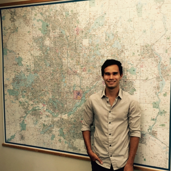
Stephen Peyton is a Graduate Research Assistant working primarily on Community GIS for the Center for Urban and Regional Affairs. Stephen’s perspective on making maps user-friendly and accessible really embodies the mission of CURA and our work with community partners. Below is a Q&A with Stephen and details on the powerful airplane noise map application he built in partnership with the MSP FairSkies Coalition. Also, we have a link to a story that the Southwest Journal published on CURA’s collaboration with MSP FairSkies.
Questions & Answers with Stephen Peyton, Community GIS Graduate Research Assistant
Share something interesting or unique about yourself? As someone who works in Geographic Information Systems (GIS), I guess it’s not much of a surprise that I am infatuated with maps. Growing up, my family moved between my two “home countries,” Japan and the United States, and I've now spent a significant amount of time in each. Still, if you were to quiz me on either the U.S. states or Japanese prefectures, I can say with confidence that I would get at least 50% of them wrong. In fact, my ability to remember states is so bad that I actually developed a U.S. states quiz to force myself to learn them, but am ashamed to say that I have seen no notable improvement.
Why did you pick your course of study? I first became interested in GIS while I was studying abroad in South Africa. As a geography major during my undergraduate career, I was researching the impact of supermarket expansion on urban food security in Cape Town. GIS eventually became a central component of my research, and allowed me to develop quantifiable statistics to support much of the qualitative research and literature around food security. Being able to develop quantitative tools and findings, which later resulted in opportunities to contribute to the academic discourse and successful grant applications for the department led me to really appreciate the problem-solving capabilities of GIS.
Today, I am pursuing a master’s degree in GIS because of what I see as the capacity of such technologies to provide insight and decision-making capabilities to invested stakeholders at many scales of analysis. My hope is to work at the intersection of spatial technologies and urban social research to develop tools to empower community leaders and policy makers.
What's been great/interesting/valuable about your work with CURA and your community partners? I think that the most valuable thing about working at CURA for me has been the opportunities I have been provided with to tackle and engage with real-world problems in a very holistic sense.
In past positions I have found myself becoming proficient at a particular task only to find that I only understand it out of its applied context. To take from my own work, understanding how to execute GIS solutions is a far cry from understanding how to support a community organization with a research project. In order to really understand how to devise appropriate, context-specific recommendations, resources, or tools, you really have to develop an understanding at all levels of engagement. I think that the way CURA collaborates with its community partners supports this model of research.
How does your project support your learning and education? MSP FairSkies is an organization which supports transparency and accountability, two principles which I believe serve as fundamental components of a representative society and engaged citizenry. As someone who seeks to develop tools which promote information sharing for community empowerment, I feel very lucky to have been involved in a project which promotes information sharing and spreading awareness. Although airplane noise is an issue which is slightly removed from my area of focus, I believe that the underlying principles behind the good work that MSP FairSkies is doing really resonates with the kind of work I hope to accomplish. Furthermore, developing this tool has been a very fruitful experience in utilizing spatial technologies to meet client needs.
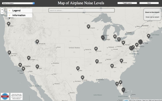
Map of Airplane Noise Levels
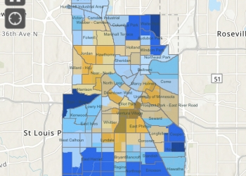
The interactive map we made showing airplane noise levels for neighborhoods surrounding the 30 largest airports in the U.S. (Note: the map is no longer live.) The map displays noise intensity in decibels (dB) - which is a logarithmic unit - for each block surrounding the airport.
We made this map in conjunction with MSP FairSkies, a coalition which promotes transparency and community involvement in FAA discussions surrounding air traffic.
“A Data Dive into Aircraft Noise” - Southwest Journal
Here are excerpts from a Southwest Journal article from August 11, 2015 by Michelle Bruch on a MSP FairSkies Freedom of Information Act request for airport noise data that CURA turned into a searchable map:
Kevin Terrell and a handful of neighborhood groups spent $1,800 on a Freedom of Information Act request to get raw data on plane noise from 89 national airports. Then he partnered with the University of Minnesota’s Center for Urban and Regional Affairs to crunch the numbers and match noise level data to census data. Now he’s published an interactive map that shows the average noise level of planes in decibels, down to the block level.
Terrell created the maps in partnership with CURA at the U of M, and the mapping became a class project. Each student in the 2015 spring semester Urban GIS and Analysis class was assigned a different airport to map. The class also linked the noise data to poverty data to see if there was any relationship. (They didn’t find much of a relationship to poverty in Minneapolis, though it’s a bit stronger in places like Chicago.)
CURA provides data and mapping assistance to about 100 nonprofits and neighborhood groups each year.
“We were also kind of interested in the government transparency angle,” said Jeff Matson, CURA’s Community GIS program director. “The FAA is collecting all this data and not readily sharing it.”
