Stephen Peyton is a Graduate Research Assistant working primarily on Community GIS for the Center for Urban and Regional Affairs. Stephen’s perspective on making maps user-friendly and accessible really embodies the mission of CURA and our work with community partners. Below is a Q&A with Stephen and details on the powerful airplane noise map application he built in partnership with the MSP FairSkies Coalition. Also, we have a…

Stephen Peyton is a graduate research assistant for CURA's Community GIS program
The Atlantic’s CityLab posted an article on a map detailing declining home ownership rates in urban areas developed by the journalist and web developer Ken Schwencke.
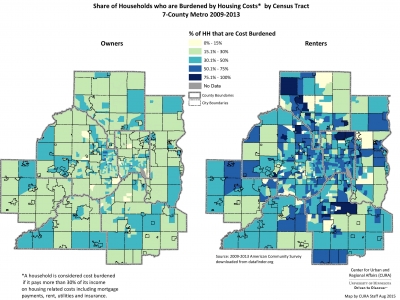
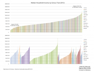
Sarah Hernandez with the McKnight Foundation suggested that a closer look be taken at renters in the Twin Cities. Here are some of the maps made in…
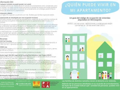
A couple of months ago, we published the English language version of the “Who Can Live in My Apartment?” flyer. We were also working on a Spanish language version and we are ready to share a draft.
We would love your feedback on the wording–we want this to be understandable by the widest possible audience. What would you change? Drop us a line, and let us know.
Download a PDF of the Spanish Language “Who Can Live in My Apartment?” flyer.
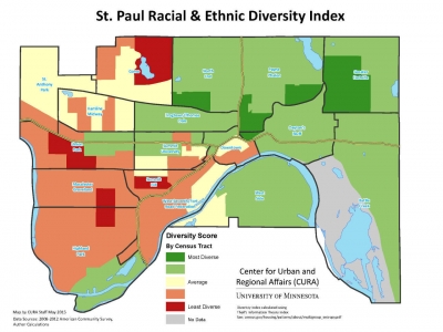
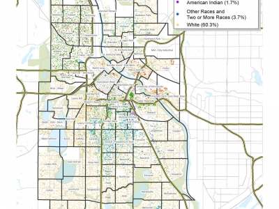
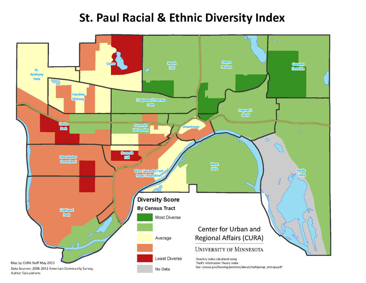
A couple of weeks ago, we posted a map of Minneapolis Racial/Ethnic Diversity Index. One of our Twitter followers very wisely requested we apply the same lens to the City of St. Paul. Here is that map.
What does this map show?
This map shows the diversity score* of St. Paul neighborhoods. “Diversity” refers to the relative proportions of racial and ethnic groups in an area (here, census tracts). An area has a high diversity score if it has more equal proportions of different racial and ethnic groups. An area with a low score has…
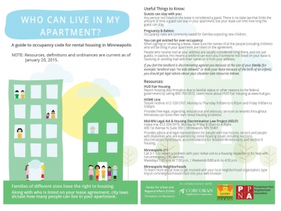
Who Can Live in My Apartment? was created by CURA staff in close collaboration with community organizers at Corcoran Neighborhood Organization, Lyndale Neighborhood Association and Powderhorn Park Neighborhood Association who are working with renters in their communities.
The flier aims to make City of Minneapolis ordinance that governs rental housing occupancy standards—which sits in both the …