Last Friday, St. Paul Mayor Melvin Carter announced the formation of a 41-Member Rent Stabilization Stakeholder Group. The Center for Urban and Regional Affairs (CURA) has been selected to convene this group with CURA Director Edward Goetz and CURA Director of Community Based Research C Terrence Anderson acting as lead facilitators. The group will meet February through May to consider improvements and enhancements to rent stabilization in St. Paul. A final report will be completed by this summer. The rent stabilization ballot measure was approved by voters 53% to 47% in the election last November.
…
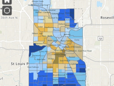
CURA’s Community GIS team created this map of Census 2020 return rates in Minneapolis and is updating it regularly through the 2020 collection period. Here is a St. Paul Census 2020 return rate map.
Click on an area to see the percentage of households who have responded to the census so far. Each area is a census tract. Click on the right arrow at top of the pop-up window to see how the current return rate…
John Vaughn has thought for years that the east side of St. Paul has not received as much funding as other parts of the city. “Anecdotally, I’ve seen the East Side has lost out on city funding to other neighborhoods,” said Vaughn recently. “Having the City Academy project funding be so severely cut pushed me to organize around finding some hard evidence of this.”
In 2015 Vaughn, who is the executive director of the East Side Neighborhood…
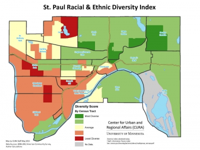
A couple of weeks ago, we posted a map of Minneapolis Racial/Ethnic Diversity Index. One of our Twitter followers very wisely requested we apply the same lens to the City of St. Paul. Here is that map.
What does this map show?
This map shows the diversity score* of St. Paul neighborhoods. “Diversity” refers to the relative proportions of racial and ethnic groups in an area (here, census tracts). An area has a high diversity score if it has more equal proportions of different racial and ethnic groups. An area with a low score has…


